Rediscover Romania: places to visit in Romania
Castles built out of grief, a prison turned into a museum, a station with its platform upstairs: a first set of Romanian places described in English.
Romania keeps a great deal of its past in places that are easy to miss from a main road: a stone church on the edge of a cemetery, a castle at the end of a village lane, a station whose platform sits on the first floor. This atlas gathers such places, one page each, with what is known about who built them, what happened to them and what a visitor can still see.
What the atlas covers
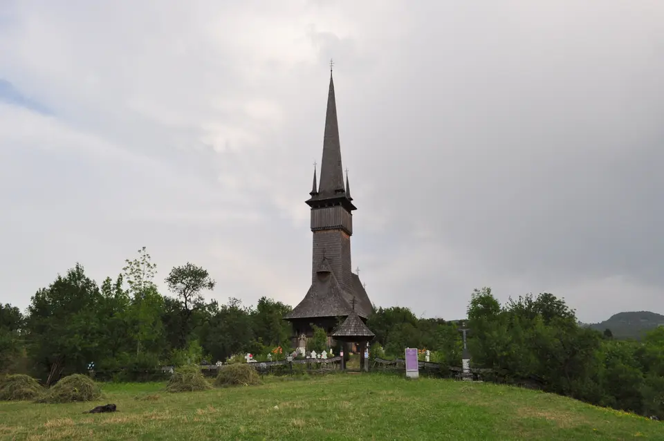
The range is wide. There are royal and noble castles, from the residences of the Prahova Valley to the country seats of Hațeg Country. There are the painted monasteries of Bucovina, whose outer walls are covered in frescoes, and the monasteries of Oltenia and Moldavia. There are medieval fortresses, the fortified Saxon churches of Transylvania, and the wooden churches of Maramureș with their tall, thin spires. Beyond the buildings come caves, glacial and mountain lakes, and the high roads that cross the Carpathians.
Each page is written to the same pattern. It starts with a concrete detail, tells the history in plain terms, separates documented fact from legend, and ends with a note on how to reach the place. Opening hours and prices are left out on purpose, as they change; every page suggests checking them with the administrator before setting off.
The full atlas is in Romanian
The complete atlas, with every place, the maps and the regional groupings, is in Romanian and starts from the list of places (in Romanian). The English section is smaller. It adapts a first set of pages for readers who do not read Romanian, keeping the same facts and the Romanian names with their diacritics, so that they match the signs on the ground.
Places in English
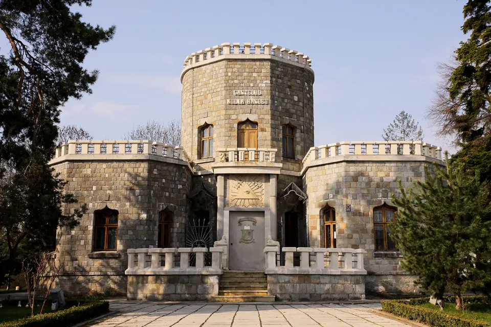
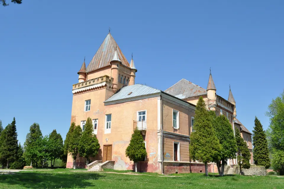
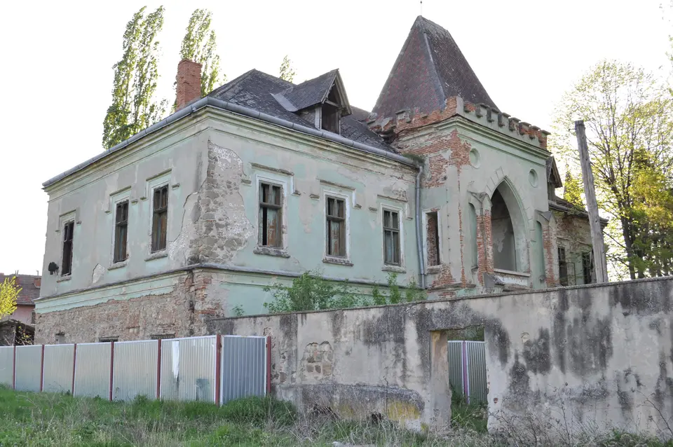
Two castles in Hunedoara County and one in Prahova open the list. Iulia Hasdeu Castle in Câmpina was built by a scholar in memory of his daughter and is wrapped in a legend of séances. Kendeffy Castle at Sântămăria-Orlea carries a Latin plaque from 1782 addressed to strangers, and Nopcsa Castle at Săcel was home to a baron who studied the dwarf dinosaurs of Hațeg Country.
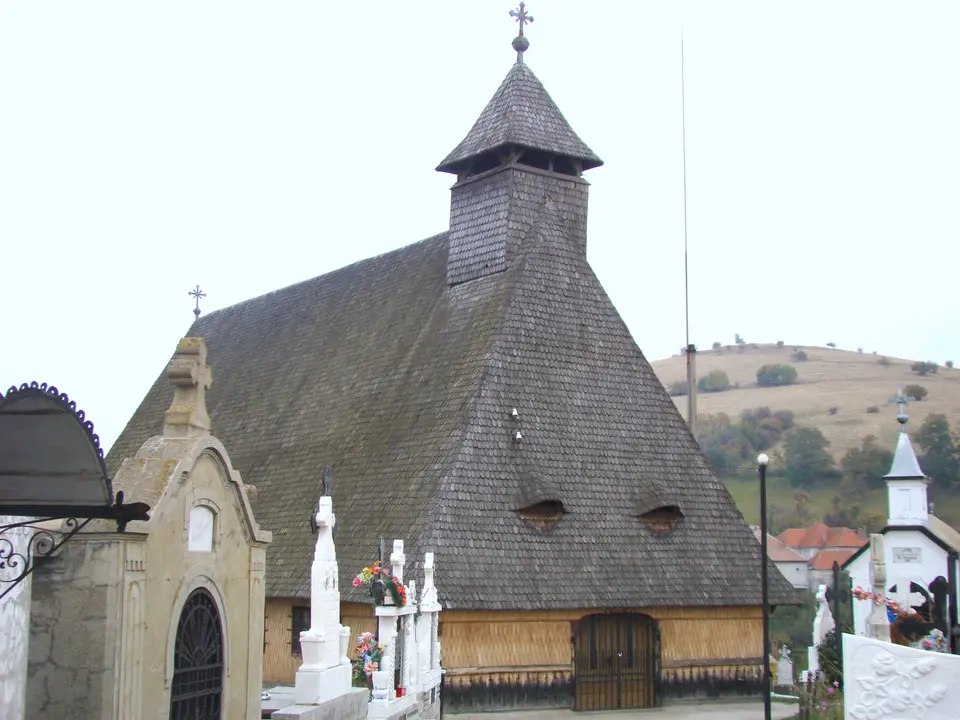
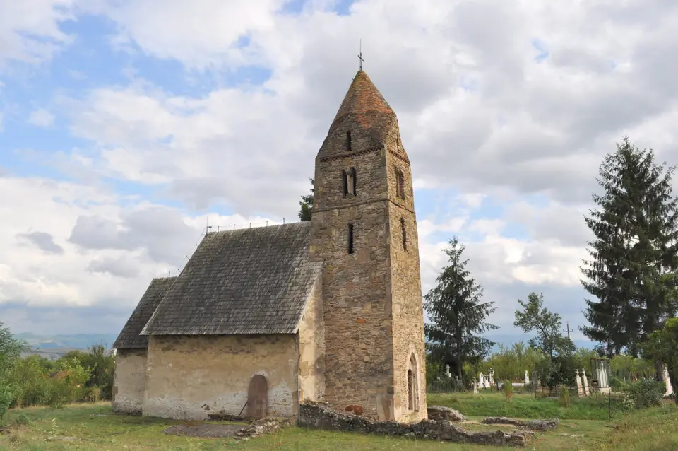
Three churches follow. The church at Strei has Roman gravestones built into its tower and, in its sanctuary, a medieval inscription naming a Grozie beside a portrait. The wooden church of Plopiș in Maramureș has a trefoil vault found in no other wooden church of the region, and the wooden church of Poiana Sibiului records its own building in a Cyrillic inscription.
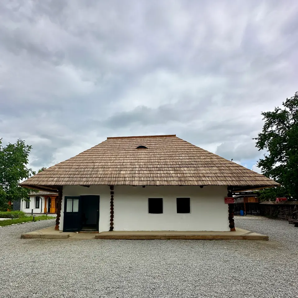
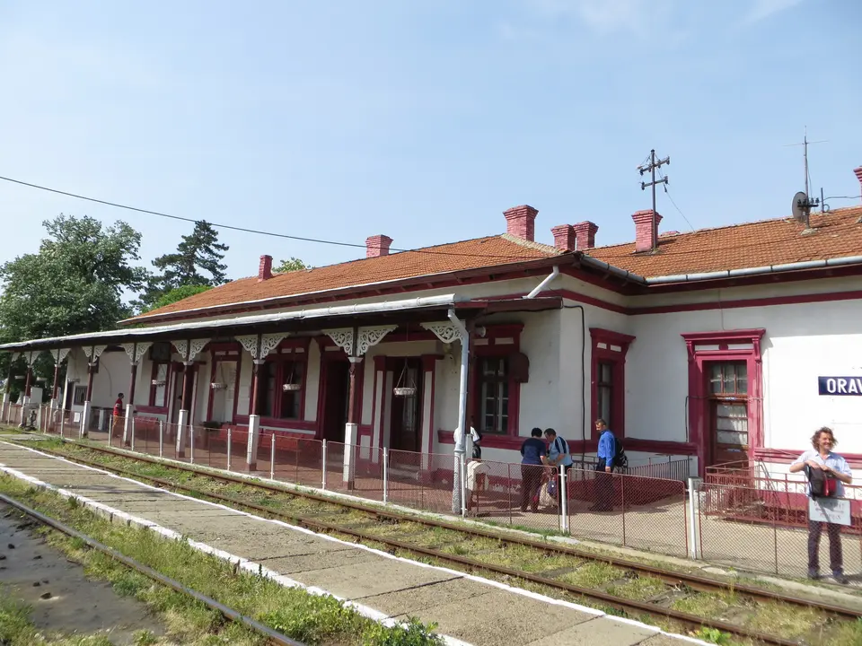
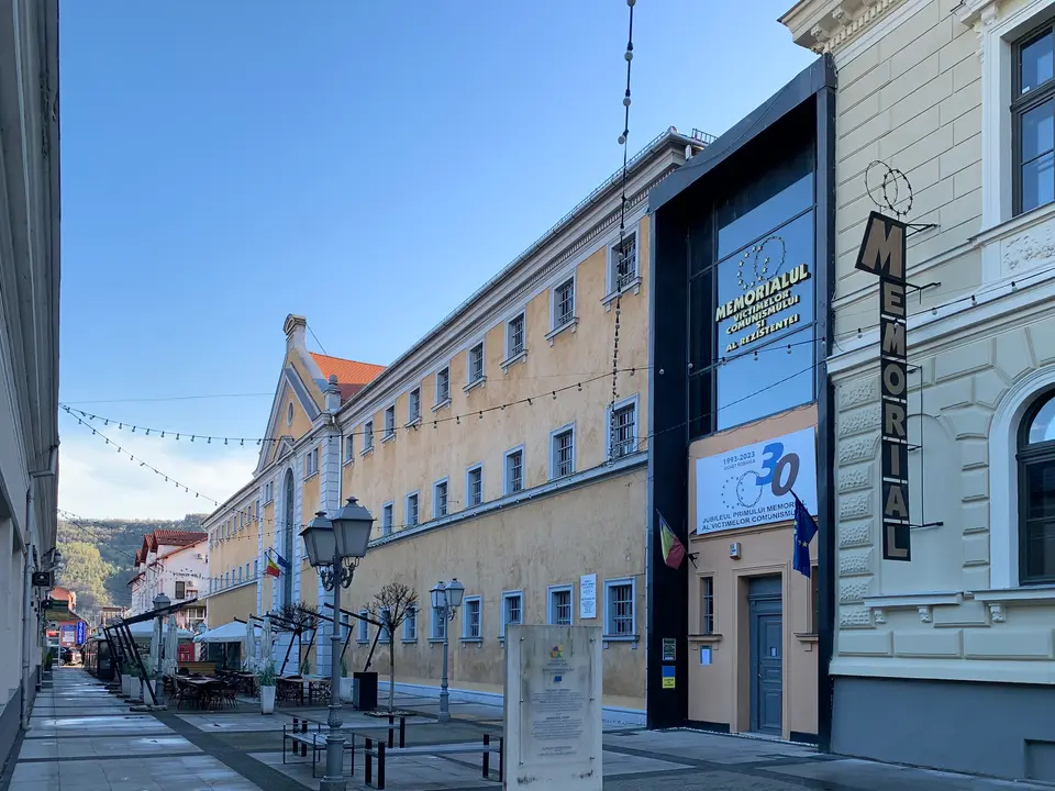
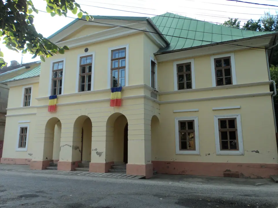
In the Banat, the town of Oravița has two pages: its railway station, considered the first in Romania, and its theatre, modelled on a Viennese playhouse. In Neamț County, the Ion Creangă Memorial House at Humulești preserves the rooms the writer described in „Amintiri din copilărie”. In the far north, the Sighet Memorial occupies a former prison where political prisoners of the 1950s were held.
How the places group on the map
Seen on a map, the ten pages fall into a few clusters. The three in Hațeg Country are close enough to share a day.
The tightest is Hațeg Country, in the south of Hunedoara County. Kendeffy Castle at Sântămăria-Orlea and Nopcsa Castle at Săcel are only about 4 km apart in a straight line, and the church at Strei lies some 14 km from Sântămăria-Orlea, beside the town of Călan. The links run deeper than distance. Strei repeats, on a smaller scale, the plan of the old church at Sântămăria-Orlea: west tower, short nave, square sanctuary. The decorator Ferenc Storno worked on the Kendeffy castle and also uncovered the first frescoes in that church. And the young Franz Nopcsa found his first dinosaur bones at Sânpetru, also in Hațeg Country. The Romanian pages add Densuș, with its tower resting on Roman altars, and Corvin Castle at Hunedoara, both within about 20 km of Sântămăria-Orlea.
Oravița, in Caraș-Severin County in the far south-west, is a single stop with two pages. The station and the theatre are roughly 2 km apart, and the town’s coat of arms carries both: a railway viaduct below two theatre masks. The mountain line to Anina, opened in 1863, makes a natural second half of the day.
In Maramureș County the two pages belong to different landscapes. Plopiș is in Chioar Land, on the Cavnic, facing Șurdești across the valley; Sighetu Marmației lies about 38 km to the north, on the Tisa, at the border with Ukraine. The Romanian region guide treats them separately: Sighet as the base for the valleys of historic Maramureș, Plopiș and Șurdești as a pair seen together, east of Baia Mare.
The other three stand on their own. Iulia Hasdeu Castle is at Câmpina, on the Prahova Valley, which the DN1 follows up to Sinaia and Bușteni; Peleș is about 29 km away. The Creangă house is in Humulești, now part of Târgu Neamț, barely 2 km from Neamț Fortress. The church at Poiana Sibiului belongs to Mărginimea Sibiului, west of Sibiu, about 30 km from the ASTRA open-air museum.
Every English page links back to its Romanian twin, which is the place to look for related sites nearby.
How the Romanian atlas is organised
The Romanian atlas uses two grids. The first is the nine historical regions: Transylvania, Banat, Crișana, Maramureș, Bucovina, Moldavia, Muntenia, Oltenia and Dobruja. They are older than the present counties and do not match them exactly; Bucovina, for instance, is most of Suceava County, while Maramureș County also takes in Chioar and Lăpuș. Each region has a guide that starts with geography and history and ends with a plan of bases and days, starting from the regions page. The second grid is twelve kinds of place, from castles and monasteries to caves, lakes and ancient sites.
Two multi-day itineraries link places in order: five days through Bucovina and Maramureș, from the painted monasteries to the wooden churches and the Sighet Memorial, and four days through the Saxon villages of Transylvania, from Sibiu to Bran. All of these pages are in Romanian, but the place names, county names and road numbers read the same in any language.
Good to know.
A few useful answers before you set off.
Is the whole atlas available in English?
No. The full atlas is written in Romanian and covers far more places than this section. The English pages adapt a selection of them, each linked to its Romanian original, with the same facts and practical notes.
What kinds of places does the atlas cover?
Castles and manor houses, painted and fortified monasteries, medieval fortresses, wooden and fortified churches, caves, mountain and glacial lakes, and the high mountain roads, along with museums, memorial houses and ancient sites.
Do the pages give opening hours and ticket prices?
No. Hours and fees are set by each administrator, parish or museum and change over time, so every page suggests checking them before the trip. The pages describe what there is to see and how to reach the area in general terms.
Which of the English pages are close to each other?
Three sit in Hațeg Country, in Hunedoara County: Kendeffy and Nopcsa castles are about 4 km apart, and the church at Strei lies some 14 km away. In Oravița the station and the theatre are about 2 km apart. Humulești, with Ion Creangă's house, lies 2 km from Neamț Fortress.